
Tanger: routes, public transport and places
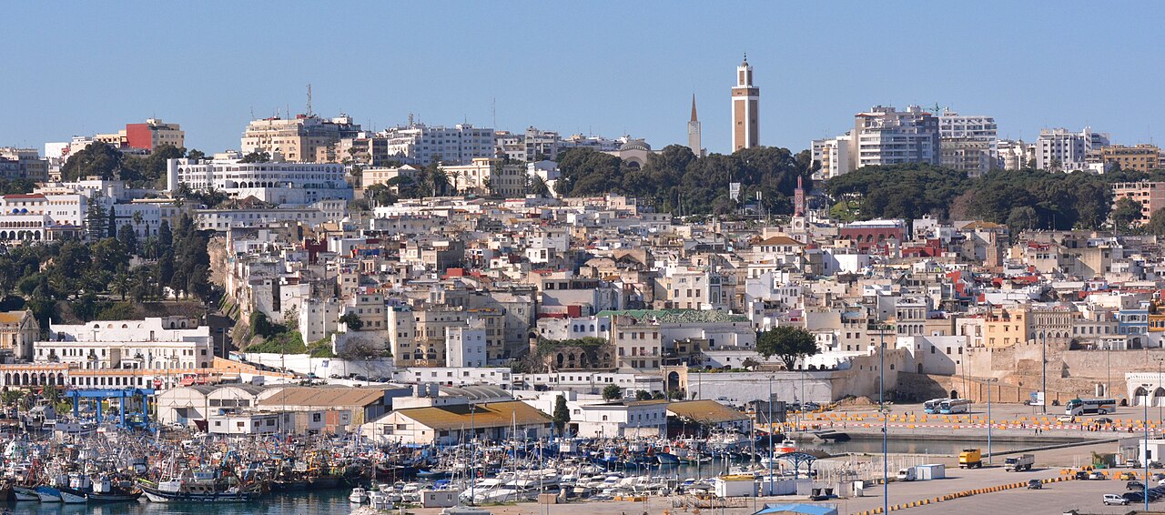
Set against the Strait of Gibraltar, Tangier combines the Tanger Med port, industrial free zones and a rebuilt waterfront.
- 1,275,428inhabitants2024 census
- 2,088addresses listed
- 20categories
- 200km² in area
- Tanger-Tétouan-Al Hoceïmaregion
All categories in Tanger
- View list
- View list
- View list
- View list
- View list
- View list
- View list
- View list
- View list
- View list
- View list
- View list
- View list
- View list
- View list
- View list
- View list
- View list
- View list
- View list
Getting to know Tanger
Tangier faces Spain across a strait barely fourteen kilometres wide at its narrowest. The Tanger-Ville port handles fast ferries to Tarifa, while Tanger Med, some forty kilometres east, is one of the leading container ports in the Mediterranean. Since 2018 the Al Boraq high-speed train has linked Tanger-Ville station with Kénitra, Rabat and Casablanca; Ibn Battouta airport is to the south-west.
The medina runs down from the Petit Socco to the port, below the kasbah and its museum; the Grand Socco joins it to the European town of Boulevard Pasteur. To the west, the Cap Spartel road follows the Rmilat forest to the Caves of Hercules; to the east, the bay and the Malabata corniche hold the newer hotels.
Other trains from Tanger
By neighbourhood
- Centre-ville 340
- Beni Makada 281
- Iberia 234
- Médina 189
- Boukhalef 100
- Malabata 79
- Marshan 78
- Kasbah 43